Info tracciato - Alpine Rally of East Gippsland Cherry Tree (Cherry Tree)
Mappa del Tracciato
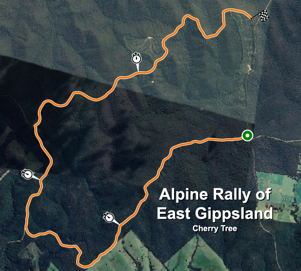
| Nome completo del tracciato | Alpine Rally of East Gippsland Cherry Tree |
| Località | Jarrahmond, Victoria |
| Nazione |  Australia Australia |
| Lunghezza | 15.630km |
| Curve | 52 |
| Coordinate GPS | -37.631448 148.418770 |
Records delle fasi
| R5 | 09:38.001 |  A. Rezervists A. Rezervists |
HYU-I20 |
Migliori Tappe Auto Private
| Nessuna registrazione |