We use cookies to improve your game experience and to analyse our traffic. We also share information about your use of our site with our social media, advertising and analytics partners.
Details
OK
We use cookies to improve your game experience and to analyse our traffic. We also share information about your use of our site with our social media, advertising and analytics partners.
Details
OK
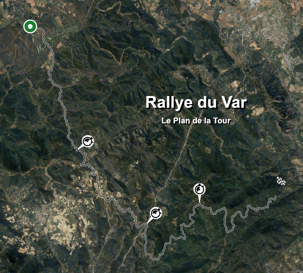
Track Map
| Track Full Name |
Rallye du Var Le Plan de la Tour |
| Location |
Vidauban, Provence-Alpes-Côte d'Azur |
| Country |
 France France |
| Length |
31.990km |
| Turns |
170 |
| GPS Coordinates |
43.394890 6.458673 |
Stage Records
Private Cars Best Stages